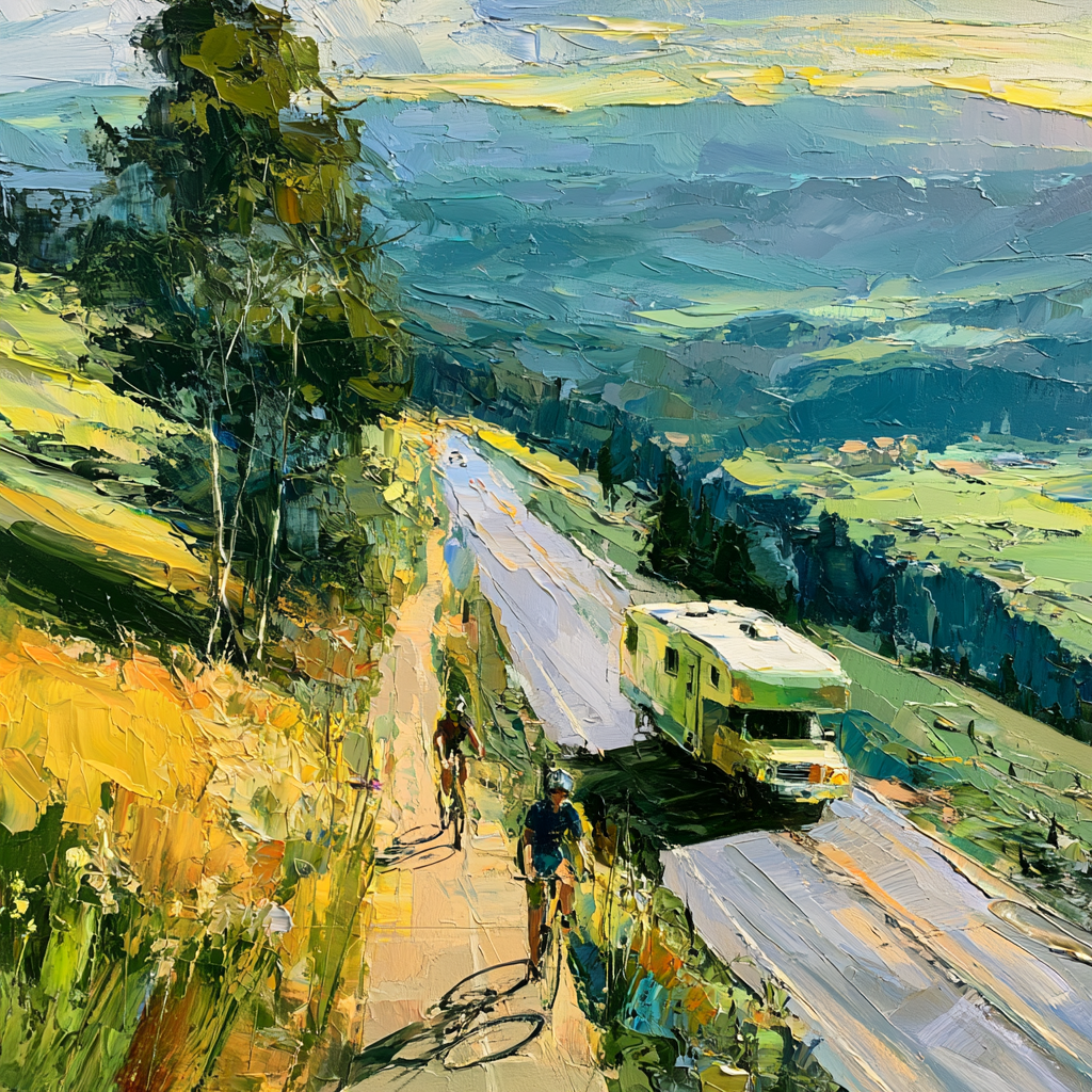
There is an obvious reason we do not already have a bike path from Steamboat Springs to Steamboat Lake: it would be extremely difficult to build.
The route would stretch roughly 24 miles up the Elk River Valley, through a complicated patchwork of public and private land. Easements would have to be negotiated. Engineers would have to account for drainage, crossings, bridges, wildlife, ranch access, snow and maintenance. Government agencies would have to cooperate. Grants would have to be found. And, eventually, someone would have to pay for the thing.
None of that makes the idea bad. It makes the idea structurally difficult.
Elk River Road is almost perfectly suited to expose the problem. It winds north through one of the most beautiful valleys in Colorado. Cyclists already ride it. Runners already use it. The Steamboat Marathon runs along it. Farther north, gravel roads and trail systems spread outward toward Clark, Hahn’s Peak and Steamboat Lake. Steamboat has an unusually strong cycling culture and a tourism economy built substantially around outdoor recreation.
And yet the road itself has become increasingly difficult to share. Cars move fast. Trucks pull trailers. Ranchers haul livestock. Campers head north. Residents commute. Road cyclists occupy the same narrow corridor without the protection that exists in places designed around multimodal transportation.
The common response is to turn this into an argument about behavior. Drivers should slow down. Cyclists should be more careful. Everyone should share the road. All of those things can be true while leaving the underlying problem untouched. The road is asking vehicles traveling at highway speeds and unprotected human bodies traveling at bicycle speeds to negotiate the same constrained space.
Behavior can improve. Infrastructure changes the conditions under which behavior occurs.
So imagine a separated paved path running from Steamboat north toward Steamboat Lake, wide enough for cyclists traveling in both directions and, where terrain allows, accompanied by a softer dirt path for runners and walkers. It could connect eventually with the gravel roads and trail systems farther north. It could make cycling safer, support running and cycling events, create another reason to visit Steamboat, and bring some of that economic activity north toward Clark, Hahn’s Peak and Steamboat Lake.
The problem begins almost immediately after imagining it: Who pays for it?
That question reveals something more interesting than the bike path itself.
We tend to imagine public projects through a remarkably narrow economic structure. Either government funds something through taxes and public revenue, or private enterprise builds it because there is money to be made. A bike path to Steamboat Lake does not fit cleanly into either category.
Its benefits would be widely distributed. Cyclists would gain safety and recreation. Drivers would have fewer vulnerable road users to pass. Local businesses could gain customers. Events could use the corridor. Tourism organizations could market it. Residents and visitors could run or walk it. Property owners and communities farther north could benefit from increased access and economic activity.
But no single institution captures enough of those benefits to make the entire project its obvious responsibility.
At the same time, the objection to simply funding it publicly is legitimate. A teacher struggling with the cost of living in Routt County should not have to accept the argument that higher taxes for recreational infrastructure obviously outrank wages, housing, transit, emergency services or existing road maintenance. Nor should a rancher along Elk River Road be told that because thousands of people might enjoy a trail, their property rights have become an inconvenience.
The mistake is assuming that because no one actor should carry the entire burden, the project itself cannot be built.
The better question is not, “Who should build the bike path?”
It is, “What would actually have to happen for the bike path to exist?”
Those are very different questions.
There is route planning. There are existing public rights-of-way. There are private easements. There are environmental constraints. There is engineering. There are agricultural crossings, drainage and bridges. There is construction. There are state and federal grants. There is private philanthropy. There are businesses that might benefit. There is public oversight. And there is the less exciting but absolutely necessary question of who maintains the thing for the next 50 years.
Once the project is separated into its actual parts, those parts have different natural owners.
Government can do things private citizens cannot. It can coordinate planning, manage public rights-of-way, establish engineering standards, pursue public grants and provide democratic legitimacy. Private philanthropy can do things government often cannot. A wealthy resident who loves cycling might decide that creating a safe route through the Elk River Valley is precisely what they want their money to accomplish. Engineers and trail builders possess expertise neither donors nor elected officials should pretend to have. Landowners control the pieces of ground necessary to connect the corridor. Businesses farther north may have an economic reason to participate.
Nobody has to do everything.
And this suggests that the first serious investment should not be pavement. It should be information.
Map the entire possible corridor. Identify every parcel. Find what is already publicly controlled. Determine which sections present genuine environmental or engineering difficulties. Talk to landowners before assuming opposition and identify those who might actually welcome an easement. Find the difficult parcels. Determine which segments qualify for grants and which might appeal to private donors. Estimate construction and long-term maintenance costs separately.
Then make that architecture public.
Instead of asking the community to contemplate “$40 million for a bike path,” imagine a public project page showing that eight miles already have viable public access, another six require easements from willing landowners, one bridge remains an engineering problem, a northern section qualifies for a state grant, three parcels remain unresolved, a donor has funded one construction segment, and a maintenance endowment still needs $2 million.
The project would cease being one enormous yes-or-no proposition. It would become a collection of finite problems.
That changes the politics as much as the financing. A donor could see exactly what a contribution accomplishes without acquiring the right to dictate public policy. A landowner would negotiate one particular easement rather than experiencing themselves as the obstacle standing between the community and 24 miles of trail. Government would not have to decide whether a bike path deserves to defeat every competing public priority. Each participant could contribute the resource they are unusually capable of providing.
There would still be hard cases. Some landowners may simply not want a public trail near their property. Some environmental constraints may make particular routes inappropriate. Construction costs may make certain sections absurdly expensive. Public money would still have opportunity costs, and private philanthropy directed toward a bike path is philanthropy not directed toward schools, housing, conservation or something else.
A serious proposal has to preserve those losses rather than bury them beneath the language of community benefit.
The same is true of bureaucracy. It is easy to ridicule red tape when it slows something we want, but most bureaucratic protections have a history. Environmental review exists because development has damaged landscapes. Easement protections exist because governments have abused property owners. Procurement rules exist because public money has been misused. Engineering standards exist because infrastructure failures hurt people.
The useful distinction is not between regulation and freedom. It is between protective friction and duplicative friction.
Protective friction catches something important. Duplicative friction asks the same people to provide the same information to disconnected agencies because nobody designed the systems to cooperate. A project like this should preserve the first while aggressively reducing the second. The environmental standard does not need to become weaker. Property protections do not need to disappear. Public accountability does not need to be sacrificed. The process simply needs to become coherent enough that protecting the public interest does not inadvertently make accomplishing the public interest nearly impossible.
Success would create problems of its own. A spectacular trail could increase recreational traffic into North Routt. Trailheads could become crowded. Businesses might benefit while nearby residents feel another layer of Steamboat’s tourism economy moving northward. Maintenance could quietly become an unfunded public liability. Wealthy donors could begin to believe that paying for public infrastructure entitles them to disproportionate influence over it.
Those are not reasons to abandon the project. They are reasons to design for the consequences of success before success arrives.
Which brings the whole idea back to a surprisingly modest beginning.
Before asking voters for money, before finding a billionaire who loves bicycles, and before spending years arguing about whether the idea is realistic, determine what is actually true. Map the route. Price it. Identify the parcels. Find the enthusiastic landowners and the reluctant ones. Determine where grants fit. Determine whether private philanthropic interest exists. Calculate what maintenance would cost.
Twenty-four miles of uncertainty becomes twenty-four miles of knowable problems.
And that may be the more interesting civic experiment hidden inside the bike path. Communities often contain far more resources than their institutions know how to combine. One person has money. Another owns land. Someone else has engineering expertise. Government possesses authority. Businesses possess economic incentive. Residents possess local knowledge.
Perhaps the scarcity is not always money, goodwill or even good ideas.
Sometimes what is missing is an architecture capable of assembling what is already there.
A bike path from Steamboat Springs to Steamboat Lake would be a remarkable thing to ride. Figuring out how to build it might teach us something even more useful.
═══════════════════════════════════════════════════════════════
DIALECTIC AND DECONSTRUCTION SOLUTIONS (DDS)
BLUEPRINT
═══════════════════════════════════════════════════════════════
Problem: Creating a safe multimodal corridor from Steamboat Springs toward Steamboat Lake when the public value is distributed, the costs are substantial, land control is fragmented, and no single public or private actor is positioned to deliver the whole project.
The DDS v11.5 engine treats a proposed solution as a structural hypothesis through the first four phases, then evaluates its actual viability in Phase 5.
PHASE 1: PROBLEM FRAMING
The Umbrella Problem
The Elk River Valley lacks a continuous, separated north-south route for cycling, running, walking, and other nonmotorized travel between Steamboat Springs and the recreational landscape north of town.
Routt County Road 129 is already the corridor used by the Steamboat Marathon, and the city describes extensive traffic controls as necessary during the race, including closures, detours, pilot cars, runners, support vehicles, and emergency apparatus.
The problem is therefore broader than recreational inconvenience. Multiple legitimate uses are attempting to occupy a transportation corridor primarily organized around motor vehicles.
The Multiple Drivers
● Physical separation deficit – cyclists, runners and motorists must use infrastructure that does not consistently separate incompatible travel speeds and vulnerability.
● Fragmented land and jurisdiction – a long corridor crosses land, rights-of-way, regulatory domains and potentially multiple forms of property control.
● Conventional funding mismatch – a project with diffuse public, tourism, transportation and recreational benefits competes against schools, housing, roads, emergency services and other necessities for finite public revenue.
● Coordination fragmentation – the organizations possessing capital, land, permitting authority, engineering competence, public legitimacy and operational capacity are not the same organizations.
● Project indivisibility – conventional civic thinking tends to present the corridor as one giant project that must be approved, funded and administered as a whole, dramatically raising the threshold for action.
This Blueprint Addresses
The physical separation deficit through a dedicated Elk River Multimodal Corridor, while constructing an implementation model capable of assembling land access, public authority, grants, philanthropy and technical capacity without requiring one institution to provide all of them.
Remaining Components
● Broader cycling safety elsewhere in Routt County
● Housing and affordability pressures
● General transportation demand in the Elk River Valley
● Regional transit expansion
● Wider reform of public-private civic project delivery
● State-level regulatory reform
This blueprint addresses the absence of a separated Elk River multimodal corridor. It does not attempt to resolve broader transportation, housing, fiscal, or governmental-process problems, which require separate interventions.
That bounded scope follows the DDS requirement that a blueprint solve one driver without pretending it resolves the entire umbrella problem.
PHASE 2: DECONSTRUCTION
The Surface Symptom
Cyclists and runners want to travel through the Elk River Valley while motor vehicles, ranch traffic, trailers, residents, commercial vehicles and visitors use the same corridor.
The visible conflict is experienced as unsafe proximity between radically different transportation modes.
The False Start
The most tempting false start is:
“Drivers need to become more respectful of cyclists.”
Driver behavior matters. Education and enforcement may improve it. But the structural condition remains: vehicles traveling at road speed and human bodies traveling at bicycle or running speed occupy the same limited transportation space.
The second false start is:
“The county should build a bike path.”
That prematurely turns a transportation problem into a public-budget problem.
The Compassionate Reality
The absence of the corridor does not require incompetence, indifference or hostility toward cycling. A 20-plus-mile corridor asks a government to coordinate property access, engineering, environmental review, construction, maintenance, liability, capital funding and public legitimacy while simultaneously funding obligations that residents experience as more essential.
Landowners likewise have rational concerns. An easement can alter privacy, agricultural operations, liability perceptions and the felt boundary between public and private land. Public agencies carry institutional memory of projects in which moving quickly created environmental, financial or procedural harm.
The obstruction is therefore distributed. Each participant can behave reasonably while the whole remains stuck.
That is the coordination gap identified in the DDS knowledge base: expertise and resources can exist while no shared architecture turns them into an executable plan.
The Upstream Drivers
● Driver 1 – Transportation Infrastructure Mismatch
Actors: Routt County, road users, cyclists, runners, residents, visitors.
Incentive/Constraint: The existing corridor must accommodate ordinary vehicular transportation, ranch access, commuting, recreation and event use.
Behavior: Different modes continue sharing limited road space because no continuous alternative exists.
Reinforcing Loop: Increased population, recreation and visitor traffic increases road use, which makes cycling feel less safe, but also makes retrofitting the corridor more expensive and complicated.
● Driver 2 – Fragmented Property Control
Actors: Public agencies, private landowners and corridor-adjacent property holders.
Incentive/Constraint: Each parcel owner controls a small portion of a project whose value only fully emerges when the segments connect.
Behavior: The project can become dependent on sequential negotiations in which a small number of unresolved segments carry disproportionate leverage.
Reinforcing Loop: Because continuous access is uncertain, governments hesitate to invest heavily in engineering. Because the project lacks engineering certainty, landowners and donors hesitate to commit. Each uncertainty reinforces the other.
● Driver 3 – Fiscal Bundling
Actors: City, county, taxpayers, elected officials, donors and grant agencies.
Incentive/Constraint: Conventional capital projects often require governments to identify a large funding source before treating the proposal as executable.
Behavior: The corridor competes conceptually with teacher compensation, housing, roads, emergency services and other politically salient needs.
Reinforcing Loop: High projected cost produces taxpayer resistance. Resistance lowers political appetite. Low political appetite prevents serious predevelopment. Without serious predevelopment, private and grant capital remain difficult to recruit.
● Driver 4 – Institutional Specialization
Actors: County government, city government, state agencies, engineers, trail organizations, nonprofits, philanthropists and businesses.
Incentive/Constraint: Each actor possesses only part of the necessary authority or capacity.
Behavior: Agencies remain inside their institutional domains rather than functioning as parts of one project architecture.
Reinforcing Loop: Nobody owns the whole coordination problem, so each unresolved dependency becomes somebody else’s prerequisite.
● Driver 5 – All-or-Nothing Project Definition
Actors: Public officials, advocates, taxpayers, landowners and funders.
Incentive/Constraint: A 24-mile corridor is cognitively and financially experienced as a single enormous undertaking.
Behavior: Discussion jumps from idea to total cost.
Reinforcing Loop: The apparent scale produces paralysis before route control, engineering, phased construction, philanthropy or grant eligibility are separately tested.
The Entry Point
The structural hinge is project decomposition.
The corridor becomes more navigable when it stops being treated as one object called “the bike path” and becomes a portfolio of separately solvable requirements: route, easements, engineering, environmental compatibility, public authority, construction segments, philanthropy, grants, maintenance and operations.
Some nodes can move while others remain unresolved. DDS explicitly permits this form of progress – holding the whole while acting on individual fragments rather than requiring simultaneous resolution.
The intervention therefore begins before construction.
Build the architecture that allows construction to become possible.
PHASE 3: DIALECTICS
Blueprint Mode – concrete civic/institutional problem.
The v11.5 engine requires the opposing values to be steelmanned and requires explicit identification of loss, sacrifice and redistributed emotional burden.
Core Tension: Individual Property Autonomy ↔ Collective Mobility and Safety
Current weighting: approximately 75% property autonomy / 25% collective corridor access
Target weighting: approximately 60% property autonomy / 40% collective corridor access
Who benefits: cyclists, runners, visitors, some residents, recreational businesses, event organizers and motorists who no longer regularly negotiate passing vulnerable road users.
Who bears cost: particularly corridor landowners whose property or operations may be affected.
What is sacrificed: some degree of exclusive control, privacy, construction tolerance and spatial autonomy along limited portions of private property.
Dialectical Narrative
Property rights protect something fundamental. A community that can convert private land into public infrastructure whenever enough people desire the outcome destroys the distinction between public interest and majoritarian preference. Ranchers and rural landowners also live with consequences that recreational users may never see: gates, livestock movement, drainage, snow management, privacy, maintenance access and the daily reality of strangers moving near working property.
Collective access protects something equally real. Property exists inside systems of roads, utilities, emergency services, water, commerce and public infrastructure. A transportation corridor serving thousands of people cannot always optimize exclusively for parcel-level autonomy.
The current weighting arose because American land-use systems appropriately place substantial burden on government when it seeks permanent access across private property. That protection restrains coercive power.
The cost is that a project requiring continuity can be defeated by fragmented negotiation even when most participants support it.
The rebalancing means voluntary easement acquisition first, meaningful compensation, route adaptation where feasible, agricultural design accommodations, and coercive mechanisms remaining extraordinary rather than routine.
What DDS holds: collective mobility can justify asking private owners to bear limited burdens, but legitimacy depends on making those burdens specific, compensated and as narrow as engineering permits.
Secondary Tension: Fiscal Responsibility ↔ Public Investment
Current weighting: approximately 70% protection of scarce public capital / 30% discretionary infrastructure investment
Target weighting: approximately 55% fiscal restraint / 45% strategic investment
A taxpayer who asks why scarce public money should subsidize a recreational corridor is protecting a legitimate public good: scarcity awareness.
A teacher struggling with the regional cost of living should not have to accept the proposition that a multimillion-dollar cycling amenity outranks compensation simply because cyclists are politically organized.
But public infrastructure also produces value indirectly. Transportation choice, recreation, tourism, safety and business activity do not always appear as direct revenue on the agency balance sheet.
The target shift therefore does not mean asking taxpayers to finance the entire corridor.
It means public government funding the portions for which government has comparative advantage: planning, rights-of-way work, grant sponsorship, engineering oversight, regulatory coordination and selected capital contributions.
The state already operates programs that illustrate this mixed model. Colorado’s Transportation Alternatives Program supports pedestrian and bicycle facilities, while the Colorado Parks and Wildlife nonmotorized trail program supports planning and construction and requires documented long-term public access.
What DDS holds: public dollars should purchase public leverage, not automatically absorb total project cost.
Secondary Tension: Efficiency ↔ Procedural Protection
Current weighting: approximately 35% efficiency / 65% procedural protection
Target weighting: approximately 50% efficiency / 50% procedural protection
Permitting, environmental review, public hearings, engineering standards and property protections contain institutional memory. They exist because speed without accountability can externalize damage.
Efficiency protects a different public interest. Every independent approval process consumes time, expertise and money. Sequential review can make the cost of complying with safeguards approach the cost of the physical intervention itself.
The useful distinction is therefore between protective friction and duplicative friction.
Protective friction detects environmental harm, engineering error, unfair land acquisition or misuse of public money.
Duplicative friction requires the same information, actors or analyses to repeatedly travel through disconnected institutional circuits.
The rebalancing retains substantive standards while attempting to integrate administration.
What DDS holds: preserve the protection. Compress the redundancy.
Secondary Tension: Recreation ↔ Essential Infrastructure
A cyclist may experience this corridor as recreation. Someone attending a community meeting may consequently hear “bike path” and place it below housing, wages or emergency services.
But infrastructure can occupy more than one category at once.
The same surface can provide recreation, transportation, event infrastructure, tourism infrastructure, physical activity, route connectivity and separation between motorized and vulnerable users.
Calling it exclusively recreational understates its function.
Calling it essential transportation overstates its function for residents who will never use it.
What DDS holds: classify the corridor by its actual portfolio of uses rather than forcing it into a single rhetorical category.
Intersection
These tensions reinforce one another.
A project framed as a public recreational amenity increases taxpayer resistance. Taxpayer resistance encourages pursuit of private capital. Private capital can create fear that wealthy interests are determining public priorities. That fear increases procedural safeguards. Increased procedure raises cost. Higher cost makes private capital more necessary.
The system can therefore produce a self-reinforcing circuit in which each solution to one legitimacy problem intensifies another.
The design must distribute not merely money, but authority.
Private actors can contribute capital without purchasing public decision-making.
Government can provide legitimacy and standards without financing everything.
Landowners can retain meaningful autonomy without possessing responsibility for whether the entire corridor succeeds.
That is the dialectical center of the project.
PHASE 4: THE MECHANISM
Title
Elk River Multimodal Corridor Partnership
Strategy
Create a single corridor project architecture that decomposes route control, planning, engineering, funding, construction and maintenance into independently actionable components while retaining unified public accountability.
Action Steps
Step 1 – Commission a Corridor Feasibility and Parcel Map
Produce an engineering-level conceptual corridor from Steamboat Springs toward Steamboat Lake identifying:
● public right-of-way
● existing public land
● parcels requiring easements
● alternative alignments
● bridges and drainage
● agricultural crossings
● environmental constraints
● logical construction segments
● trail-system and gravel-road connections
● preliminary maintenance needs
Rationale: Right now much of the impossibility is undifferentiated. A route map converts “we would need countless easements” into a finite set of known parcels and problems. Uncertainty itself is currently carrying load in the system.
Step 2 – Build a Public Corridor Ledger
Create a public-facing project dashboard in which every major component carries a status:
Resolved / Negotiating / Fundable / Funded / Permitting / Blocked / Construction Ready
Examples:
● Segment A engineering
● Segment B easements
● bridge crossing
● wildlife review
● philanthropic capital
● TAP eligibility
● CPW eligibility
● maintenance endowment
● trailhead connection
Rationale: A donor should be able to see what money accomplishes. A landowner should be able to see what remains unresolved. A government official should be able to see which institutional action releases another node. Coordination becomes visible rather than interpersonal.
Step 3 – Separate Funding by Comparative Advantage
Create several capital channels rather than one tax-funded project.
Public funding: planning, engineering, grant match, public-right-of-way improvements and components with direct transportation function.
State/federal grants: eligible planning, bicycle/pedestrian and trail segments.
Private philanthropy: major capital gifts, easement acquisition, construction segments, amenities or maintenance endowment.
Business participation: trailheads, visitor services, event partnerships and components producing identifiable commercial benefit.
User/event revenue: maintenance contributions where appropriate, without transforming basic corridor access into an affluent-user enclave.
Colorado currently recognizes bicycle and pedestrian facilities within TAP, while CPW’s nonmotorized program funds trail planning and construction. CPW’s program also allows eligible governmental bodies and charitable organizations to apply, which opens more than one potential institutional channel.
MMOF also recognizes bicycle and pedestrian projects and allows several types of public and nonprofit entities, though CDOT currently says another call for projects generally is not expected until 2027 or later and additional funding is not expected until FY2031.
Step 4 – Create the Easement Compact
Approach affected landowners with a standardized but adaptable package:
● exact surveyed footprint
● compensation methodology
● fencing/gating options
● livestock crossing design
● privacy buffering
● construction schedule protections
● drainage commitments
● maintenance responsibility
● liability language
● relocation provisions where feasible
● named point of contact
The first objective is not unanimous agreement.
The first objective is to discover where agreement already exists.
Rationale: Treating every landowner as an anticipated opponent creates unnecessary opposition. Treating every landowner as an automatic supporter creates betrayal later. Differentiation allows enthusiastic parcels to move while unresolved parcels receive proportionate attention.
Step 5 – Build in Phases That Produce Independent Value
Do not wait for all 24-ish miles to become available.
Potential structure:
Segment 1: town to a logical northern connection
Segment 2: next high-readiness rural stretch
Segment 3: Clark-area connection
Segment 4: Steamboat Lake connection
Exact segmentation belongs to engineering, not assumption.
Each completed segment must produce usable value rather than terminate meaninglessly.
Rationale: DDS permits one node to move while another remains unresolved. Progress becomes cumulative instead of hostage to the least-ready segment.
Step 6 – Design Two Surfaces Where Feasible
The preferred section becomes:
Paved bidirectional cycling/mobility path + adjacent softer running/walking surface
Where terrain, ecology, right-of-way or cost make dual surfaces unreasonable, the corridor compresses to a shared paved multimodal trail rather than losing continuity.
The Leadership
Steward: Routt County-designated senior project authority or joint city-county corridor authority.
Because the route is County Road 129/Elk River Road north of town, Routt County necessarily belongs near the center of the jurisdictional architecture; city involvement is also relevant where the corridor enters Steamboat Springs. The city’s own 2026 marathon notice identifies the road as Routt County Road 129.
Facilitator: Dedicated Elk River Corridor Project Director housed within the steward organization or a contracted nonprofit/public-benefit project entity.
Subject Matter Team: civil transportation engineer, trail planner, land/easement counsel, agricultural representative, wildlife/ecology specialist, grant specialist and construction-cost estimator.
Community Representatives: corridor landowners, cycling/running users, North Routt residents, business representatives, accessibility users and general taxpayers.
The distinction matters because DDS assigns leadership by function rather than charisma: steward holds accountability; facilitator manages the process; experts provide domain competence; community representatives preserve stakeholder reality.
The Timeline
Phase 1 – Stabilization / Definition: Months 0-12
● feasibility study
● corridor mapping
● land-control inventory
● preliminary environmental screening
● landowner listening
● preliminary cost model
● project ledger
● philanthropic prospectus
● grant calendar
● first segment identification
Phase 2 – Implementation: Years 1-6+
● acquire easements by segment
● final engineering
● obtain permits
● assemble public/private capital stack
● construct independently useful sections
● connect sections as readiness grows
Phase 3 – Review: Annual beginning Month 12
Measure:
● percentage of corridor under site control
● funding committed
● construction-ready mileage
● completed mileage
● cost per mile
● maintenance liabilities
● landowner disputes
● safety outcomes
● usage
● tourism/event use
Cost Analysis
Financial Cost
Working planning placeholder: $30 million-$70 million total corridor capitalization.
This is not an engineering estimate. It is deliberately a broad DDS planning range reflecting the length described in the problem, paved construction, possible secondary surface, drainage, bridges, easements, engineering, environmental work, contingency and rural mountain construction.
The first expenditure should therefore be a comparatively small feasibility/design package that replaces this placeholder with a defensible segment-by-segment cost estimate.
A DDS blueprint loses integrity if an invented precise number is allowed to masquerade as competence.
Opportunity Cost
Public dollars contributed here cannot simultaneously fund housing, wages, existing road maintenance, transit, emergency services or other capital priorities.
Private philanthropy directed here is likewise unavailable to schools, housing, conservation, arts or other community needs.
Human Cost
County and city staff acquire another complex, long-horizon project.
Landowners participate in negotiation and construction disruption.
North Routt residents absorb temporary construction effects and potentially increased recreational traffic.
Someone must manage this project for years.
Key Assumptions
Assumption 1
Enough feasible alignment exists to create continuity.
If wrong: redesign around parallel roads, limited on-road protected segments, property acquisition or a shorter destination.
Assumption 2
A meaningful percentage of affected landowners will voluntarily participate.
If wrong: the project must change alignment, narrow its scope or explicitly confront whether compulsory acquisition is legitimate.
Assumption 3
Private philanthropy has meaningful appetite for a high-visibility outdoor-recreation legacy project.
If wrong: reduce scope and emphasize grant/public-capital sequencing.
Assumption 4
The corridor can produce independently valuable phases.
If wrong: the project becomes more financially fragile because value depends on near-total completion.
Assumption 5
Environmental and wildlife constraints can be mitigated through alignment, timing and design.
If wrong: reroute or abandon ecologically inappropriate segments.
Assumption 6
Long-term maintenance can be funded without creating an escalating burden on ordinary taxpayers.
If wrong: capital construction should pause until a durable maintenance model exists.
The Evidence
There is no direct analog established here for this exact 24-mile public-private corridor model.
The relevant precedent is modular rather than exact.
Colorado’s existing funding architecture already recognizes nonmotorized trail planning and construction as legitimate grant categories. CPW requires funded properties to remain under applicant control or authorized access and generally open to the public for at least 25 years, demonstrating that long-term easements and mixed ownership are administratively recognizable structures.
CDOT’s Transportation Alternatives Program explicitly includes pedestrian and bicycle facilities and frames them as transportation investments that expand travel choice and can strengthen local economies and quality of life.
Primary Analog: None – novel integrated financing and coordination structure.
Theoretical Basis: distributed-resource coordination. The intervention assumes the limiting resource is not necessarily aggregate community wealth, authority or competence, but the absence of an architecture capable of combining them.
Emotional Consequence
Relief Profile
Cyclists and runners gain physical separation from fast-moving vehicles. Drivers lose some of the repeated vigilance involved in overtaking exposed road users. Parents may experience the corridor differently when recreational movement no longer requires accepting the same degree of proximity to highway-speed traffic.
For donors and public officials, a visible project ledger replaces the strange emotional burden of being asked to believe in an enormous abstraction.
Burden Profile
Some landowners experience the deepest loss. Even compensated access can feel like a permanent alteration in the boundary of home, ranch or land. Rural residents may also experience increased recreational use as another increment of Steamboat’s tourism economy moving northward.
Taxpayers may reasonably fear a familiar civic pattern: privately enthusiastic people secure a project, then long-term maintenance quietly migrates onto the public balance sheet.
Those burdens require architecture rather than reassurance.
Feasibility Check
Authority & Hiring
Who creates the Steward/Facilitator roles?
Routt County would need to designate or authorize the lead structure, ideally through a formal intergovernmental arrangement with Steamboat Springs for portions touching city jurisdiction.
New position budget:
Initial project-director cost belongs inside feasibility/predevelopment funding and could itself be philanthropically underwritten rather than assumed as permanent county headcount.
What gets deprioritized?
If existing staff absorb the work, other planning and capital projects necessarily lose capacity. DDS therefore favors dedicated project management.
Enforcement Teeth
If the Steward fails to follow through:
Regular public milestone reporting and formal governing-body review.
When stakeholders resist:
The Facilitator possesses negotiating and coordination authority, but not unilateral authority to override property rights or statutory review.
Who can cancel the program?
The governing public body controlling the project and capital authorization.
Coordination Reality
Meetings:
Approximately two project-team meetings monthly during predevelopment, with specialized working groups as needed.
Existing committees replaced:
None assumed. The intent should be one corridor team replacing multiple ad hoc project-specific conversations wherever legally possible.
Data owner:
Project Director maintains the corridor ledger and authoritative project record.
Decision Authority
Conflict: Steward organization within delegated authority.
Escalation: Project Director → Steward → governing public body, with legal/regulatory matters routed to the agency possessing statutory authority.
Budget authority: remains with whichever entity owns each funding source. Private donors do not acquire public regulatory authority through contribution.
That last boundary is essential.
PHASE 5: READINESS & AUDIT
DDS scores readiness only here, after carrying the proposal without prematurely judging it.
Readiness Scores
Psychological / Social Capacity: 7/10
The corridor aligns strongly with Steamboat’s outdoor-recreation identity, while landowner concerns and perceptions of affluent recreational subsidy create genuine resistance. The emotional problem is localized rather than universal.
Political / Institutional Alignment: 5/10
The necessary forms of government authority exist in pieces, and Colorado has active-transportation funding mechanisms. But the corridor crosses institutional boundaries, and no dedicated governing architecture for this specific project has yet been established. Current state funding streams also have timing and match limitations.
Operational / Resource Feasibility: 5/10
The project is technically intelligible but operationally demanding. Long linear corridors magnify easements, environmental constraints, drainage, engineering, maintenance and cost uncertainty.
Cultural / Existential Fit: 8/10
A long cycling/running connection through the Elk River Valley fits unusually well with the community’s established recreation and destination-event culture. The Steamboat Marathon already uses CR 129 as a signature event corridor.
Verdict: PROCEED
Proceed does not mean build.
It means the idea is ready for structured predevelopment.
The cultural alignment is strong enough to justify testing the difficult variables. The institutional and operational scores remain moderate because the decisive facts are not yet known: alignment, parcel control, environmental constraints, capital cost and landowner willingness.
The first success is therefore not pavement.
The first success is replacing imagined obstacles with measured ones.
Minimum Viable Mechanism
Because no score falls below 5, the engine does not technically require an MVM. But a low-cost validation step remains structurally useful.
Action: Create a 60-day Elk River Corridor Opportunity Scan.
Timeline: 60 days.
Output: preliminary GIS alignment, public-land/right-of-way inventory, parcel count, five major constraint zones, three possible construction segments, rough-order cost range, grant inventory and confidential exploratory interviews with a representative sample of affected landowners.
Success Metric: a technically plausible corridor exists and enough land-control pathways appear potentially negotiable to justify formal feasibility engineering.
Failure Metric: unavoidable alignment barriers, ecological conflicts or land-control barriers make continuity implausible without disproportionate coercion or expense.
The Fractal Audit
Solving road conflict creates access success, and access success creates its own pressure.
A spectacular corridor could increase cycling tourism, event activity and recreational traffic into North Routt. Businesses may benefit while residents experience another layer of visitation, parking demand, trail pressure and cultural change.
The project could also become a victim of its financing success. Wealthy donors who fund large portions may begin to experience legitimate generosity as deserving disproportionate influence over design or priorities.
The solution therefore creates a new governance problem:
New Problem Node
Managing the growth, maintenance and power effects created by successful recreational infrastructure.
Private generosity must remain contribution rather than governance purchase.
Kill Switch
The corridor should be paused or materially redesigned if any of the following occurs before major construction:
● projected lifecycle maintenance lacks a durable funding source;
● route completion becomes dependent on widespread coercive property acquisition rather than limited exceptional use;
● environmental review identifies impacts that cannot be reasonably mitigated;
● updated engineering costs rise enough that funding the corridor requires displacement of higher-priority public commitments inconsistent with the diversified-financing premise;
● completed early segments fail to demonstrate meaningful use or connectivity sufficient to justify subsequent capital.
DDS explicitly requires measurable failure conditions so institutions can learn rather than defend a project merely because they have already invested in it.
Capacity Impact Assessment
Individual: The architecture allows residents and stakeholders to distinguish personal preference from public consequence.
Relational: Landowners, users, donors and governments retain differentiated roles rather than being forced into one political identity.
Embodied: The physical intervention directly changes the lived experience of vulnerability between motor vehicles and unprotected road users.
Integrity: Costs and beneficiaries remain visible rather than hidden beneath the language of universal public benefit.
Dialectical: The project requires the community to hold recreation and necessity, property and commons, philanthropy and democracy, speed and regulation simultaneously.
Engaged: The ledger turns generalized support into specific forms of participation.
Interconnected: The corridor becomes legible as transportation, recreation, tourism, land use, ecology, agriculture and community identity operating within one system.
The DDS knowledge base defines successful interconnected capacity as caring for the whole while maintaining right-sized responsibility for particular parts.
PHASE 6: NARRATIVE SYNTHESIS
The apparent problem is a bike path.
The structural problem is that a community can possess the money, enthusiasm, technical competence, public authority, land and economic incentive required to produce something while those resources remain distributed among actors who cannot individually complete the project.
The current road embodies that fragmentation. Motorists need transportation. Ranchers need working access. Cyclists want recreation and mobility. Runners want a safer surface. Landowners want control over their property. Government protects procedure and scarce public resources. Wealthy residents may possess capital but no legitimate authority to direct public infrastructure.
None of those interests is absurd.
The project becomes navigable when we stop requiring one of them to become dominant.
Government does not need to pay for everything. Philanthropy does not need to govern. Landowners do not need to become trail advocates. Cyclists do not need to persuade taxpayers that cycling outranks housing or teacher compensation.
Each participant can carry the portion for which they possess unusual capacity.
The first practical move is therefore almost anticlimactic: map the corridor completely. Find the land already available. Find the landowners already enthusiastic. Find the ecological constraints that are actually real. Identify the difficult parcels. Separate grant-eligible components from philanthropic ones. Separate capital construction from perpetual maintenance.
Twenty-four miles then stops being twenty-four miles of uncertainty.
It becomes a series of finite problems.
The tension remains. Someone gives up something. A landowner may surrender a strip of exclusive space. A donor gives money that could have served another cause. Public staff spend attention here rather than elsewhere. Residents may inherit more visitors. Government accepts responsibility for managing another durable piece of infrastructure.
DDS does not remove those losses. It refuses to hide them.
What changes is that the community no longer has to decide whether it “supports a bike path” in the abstract. It can examine a specific corridor, segment by segment, parcel by parcel, dollar by dollar, burden by burden, and discover where actual possibility ends.
The completed trail would be useful.
The deeper accomplishment would be competence made visible: a community learning how to translate a desirable but apparently unrealistic idea into an architecture of accountable parts.
PHASE 7: COMPONENT STATUS
Umbrella Problem: Lack of continuous separated nonmotorized mobility between Steamboat Springs and the recreational corridor toward Steamboat Lake.
This blueprint addressed: Creating a diversified implementation architecture for the Elk River Multimodal Corridor.
Remaining Components:
● engineering-grade route feasibility
● exact parcel/easement inventory
● environmental and wildlife analysis
● defensible capital-cost estimate
● landowner willingness assessment
● precise jurisdictional mapping
● philanthropic appetite
● lifecycle maintenance structure
● segment sequencing
● formal city/county governance arrangement
Status: Component 1 of approximately 10 complete – conceptual architecture established; empirical feasibility remains unresolved.
Phase 7 is mandatory in DDS specifically to prevent a strong narrative or mechanism from becoming a “silver bullet” story.
PHASE 8: HOW WOULD YOU LIKE TO PROCEED?
[A] Publish This Blueprint
Mark the conceptual component complete.
[B] Solve Next Component
The strongest next DDS target is actual corridor feasibility: route, parcels, jurisdiction, easements, existing public land, grants and rough costs.
[C] Revise This Blueprint
● Deconstruction
● Dialectics
● Mechanism
● Feasibility
● Narrative
[D] Clarify Before Proceeding
[E] Start Fresh
Run the second DDS on the larger meta-problem: how communities separate the variables of public-good creation and allocate them across public, private, nonprofit and philanthropic actors according to comparative capacity.